Dug
Gap is located on Pigeon Mountain a short distance to the
northeast of LaFayette, Georgia. The area appears on the
LaFayette, Georgia quadrangle of the U. S. Geological Survey
maps.

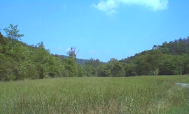
Dug Gap looking East
HISTORICAL
SIGNIFICANCE
Dug Gap in Pigeon Mountain provided access to LaFayette
from Stevens' Gap coming off Lookout Mountain. During the
Confederate withdrawal from Chattanooga it became apparent
that Pigeon Mountain would have strategic value by providing
a second barrier to Federal forces coming over Lookout Mountain.
This being the case, provisions were made to block and defend
the gaps. On September 8, Confederate cavalry from General
William T. Martin's command started the job of blocking
the gaps, using large rocks and cutting down trees across
the road. The next day, General Patrick Cleburne's infantrymen
strengthened the positions by digging rifle pits and building
breastworks. The infantry remained in the gap until September
17 when they were relieved by cavalrymen from Joseph Wheeler's
command.
|
General James Negley's Federal
division was stopped at Dug Gap on September 10. While the
Confederates were unsuccessful in their plan to destroy
Negley's Division, they did successfully hold the gap. After
the battle at Davis' Crossroads, there were a number of
Federal probes against the gaps, but in each case they were
turned back "I have the honor to send you the following
information," Negley wrote on September 15, "received from
a small squad of men sent out to-day for the purpose of
observing the movements of the enemy: Straight through Dug
Gap there is a low hill covered with trees. The top appears
to be cleared; along the top are four large trees, equidistant
apart; on the left end is a large pine 100 yards to the
left of which appears to be an embankment, running east
and west. On the right of the same tree is an embankment
with a wagon road at the foot of it. On the brow of the
hill to the right of the road are numerous objects resembling
wagons. To the right about 400 yards is another tree. Between
the second and third trees is an embankment running north
and south, about 300 yards long; from the third to the fourth
tree, the same bank extends. The top appears to be open
and guns, or what resembles them, are plainly visible through
glass. There are a great many of them. Behind the hill an
immense cloud of dust rises; it is in the direction of LaFayette."
|
References:
Official Records of the War of the Rebellion
Archive and files, Chickamauga and Chattanooga National Military
Park
Raymond Evans, The Civil War in Walker County
Significant
Views: Modern Georgia Highway 193 passes through Dug Gap,
and the site can also be seen from several places in the valley.
Setting:
The site is in a highly a rural setting and much of it is
a part of a wildlife area managed by the state of Georgia.
Documented
Structures, Sites and Features: There are no known wartime
features remaining on the site.
Presumed
Wartime Features: The Gap was occupied September 8 to
17, 1863. There could be numerous Confederate and Federal
campsites and other features in the area.
Original
Terrain: The general terrain in the vicinity of this site
still retains much of its wartime condition.
Related
Sites: Blue Bird Gap, Catlett's Gap, and Worthens' Gap. |